

Winter Weather Advisory extended into Austin County
Bellville ISD cancels school Thursday, Sealy ISD announces early release
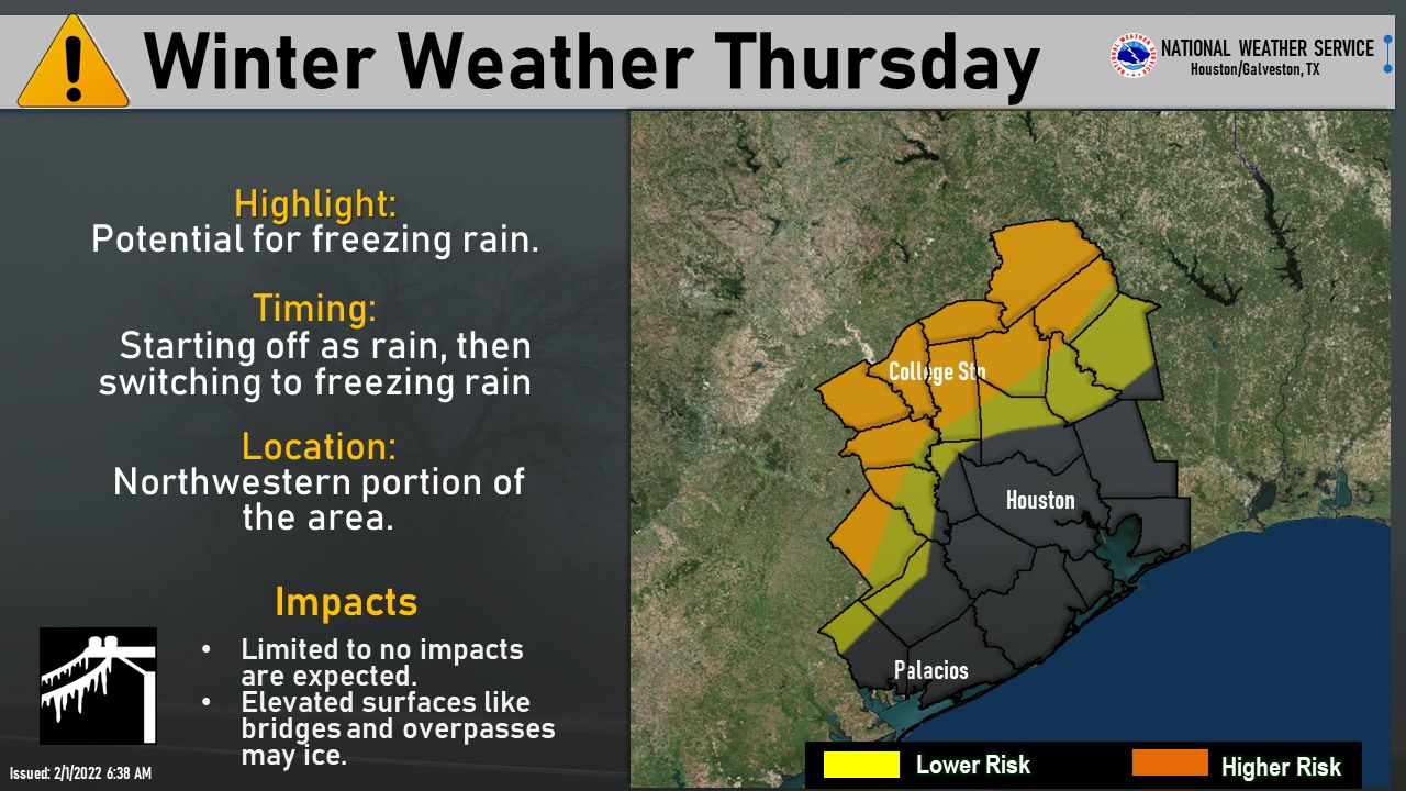

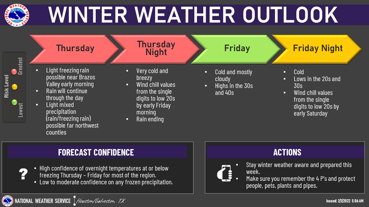
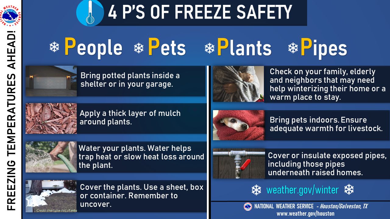
Wednesday morning, the National Weather Service extended its Winter Weather Advisory area to include Austin County from 6 a.m. Thursday, Feb. 3, to 9 a.m. Friday, Feb. 4.
The extension statement said a “mix of light freezing rain and ice pellets are possible for these areas (Austin and Colorado County). Ice accumulations up to a tenth of an inch is possible,” which could also produce “slippery conditions on elevated roadways, bridges and overpasses.”
For precautionary actions, NWS advised to “be prepared for slippery roads and limited visibilities … and use caution while driving.”
Austin County Emergency Management Coordinator Roy Mercer offered road safety tips in a Wednesday afternoon interview.
“The Kenney bridge on (Highway) 36 is usually the first bridge to freeze over due to the fact that it's higher up in the air so it gets those buffing winds underneath,” said Mercer. “Make sure that you test all your vehicles, you start them. Make sure you have your tanks full of gas when you travel. But be aware of all the alerts that's coming out and again look on our website and see which roads are iced over and things of this nature. TxDOT also has that information on their site as well.”
He cited austincounty.com as a source for residents to receive updates and reading information.
“Please read the links, there are some good links at the bottom of the page. You can actually look at charts to see when the wind starts coming in, (when) precipitation is going to happen and the freezing rain,” Mercer said.
SCHOOLS: Bellville cancels, Sealy delays open Thursday
Wednesday at 8:18 p.m., Bellville ISD announced schools would be closed Thursday and Friday will start with a two-hour delay. Faith Academy of Bellville followed suit with BISD protocols and also canceled school Thursday.
"We have been monitoring our forecast for winter weather every hour and the most recent shift has freezing conditions reaching our area by noon tomorrow," BISD's Wednesday night statement says. "We are cancelling school for BISD for Thursday, February 3. At this time, we are anticipating return on Friday, February 4 with a two-hour delayed start."
Wednesday afternoon, Sealy ISD announced it will run an early-release dismissal Thursday afternoon.
“Due to the updated forecast, Sealy ISD will have an early release Thursday, February 3rd,” Sealy ISD announced at 3:56 p.m. Wednesday. “Campuses will release at the following times: High School – 11:45; Junior High – 11:50; Elementary Schools – 12:15. Look for information regarding Friday’s schedule tomorrow afternoon.”
Brazos ISD said it was monitoring the weather and expected normal business operations for Thursday and Friday but was ready to adapt if needed.
“(Brazos) ISD makes every effort to decide school cancellations or change of schedules as early as practical to provide families with time to adjust their plans,” Brazos ISD Superintendent Scott Rogers said Wednesday afternoon. “I will make a decision based upon the weather service information, school leadership and board input, along with information received from adjacent school districts.”
LINDNER: "Routine" event for southeast texas upcoming
In a 6:30 p.m. update, Jeff Lindner, Director Hydrologic Operations Division/Meteorologist for Harris County Flood Control District, said the "upcoming winter weather event will be fairly 'routine' for (southeast texas)" and expected minimal impact.
"Patchy ice on bridges, overpasses and flyovers will be the biggest threat," he said Wednesday night. "Surface streets, parking lots, and sidewalks will be fine. There may be a period of 12-18 hours over the area where vehicle travel on bridges and overpasses could be a concern from mid-evening Thursday to mid-morning Friday. Critical infrastructure damage or failures in critical services (power, water, natural gas, ect) is unlikely with this event in SE TX."
Earlier in a noon update, Lindner said the Texas Department of Transportation had already started treating the roads to combat the possible freeze.
“Winter weather advisory now for all areas along and north of U.S. 59 … including the metro Houston area this is mainly for light freezing rain after 4-5 p.m. on Thursday and most likely Thursday evening into Friday morning,” Lindner said Wednesday. “TXDOT has begun applying anti-ice solution on bridges and overpasses over portions of the area.”
NWS predicts wind chills will plunge temperatures to near 10 degrees Thursday night and closer to 20 degrees Friday night which shouldn’t replicate the cold brought from Winter Storm Uri nearly a year ago.
“Preparations for widespread freeze across the region should be completed,” Lindner said in a 3 p.m. update Wednesday. “At this time temperatures do NOT look to fall into Hard Freeze thresholds across the Houston metro area and instead lows on both Friday and Saturday mornings in the 28-31-degree range. Temperatures may be below freezing across the metro area between 6-9 hours both nights.”
Lindner said major impacts of the front included:
- Along and north of US 59 (Winter Weather Advisory areas): ice accumulation of .01 to .10 of an inch is possible stating as early as 3-4 p.m. on Thursday (Colorado, Austin, Washington, Waller, Montgomery Counties);
- Ice accumulation is NOT expected to be great enough to cause damage to tree limbs or power lines even with gusty winds over the area; and
- Main threat from any ice accumulation will be vehicular travel on any bridges or overpasses Thursday night/Friday morning (possible impacts to the Friday morning rush hour).
This is a developing story, stay tuned to sealynews.com and The Sealy News' social media pages for updates as they become available.
