

Wintry precipitation possible tonight
Austin County being monitored for potential Winter Storm advisory

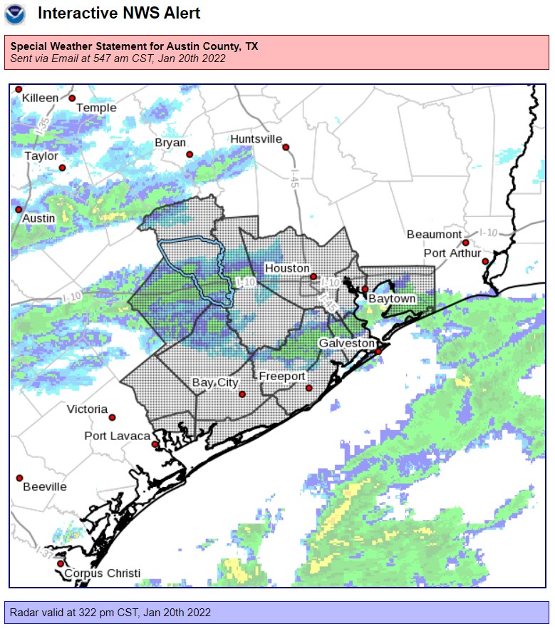
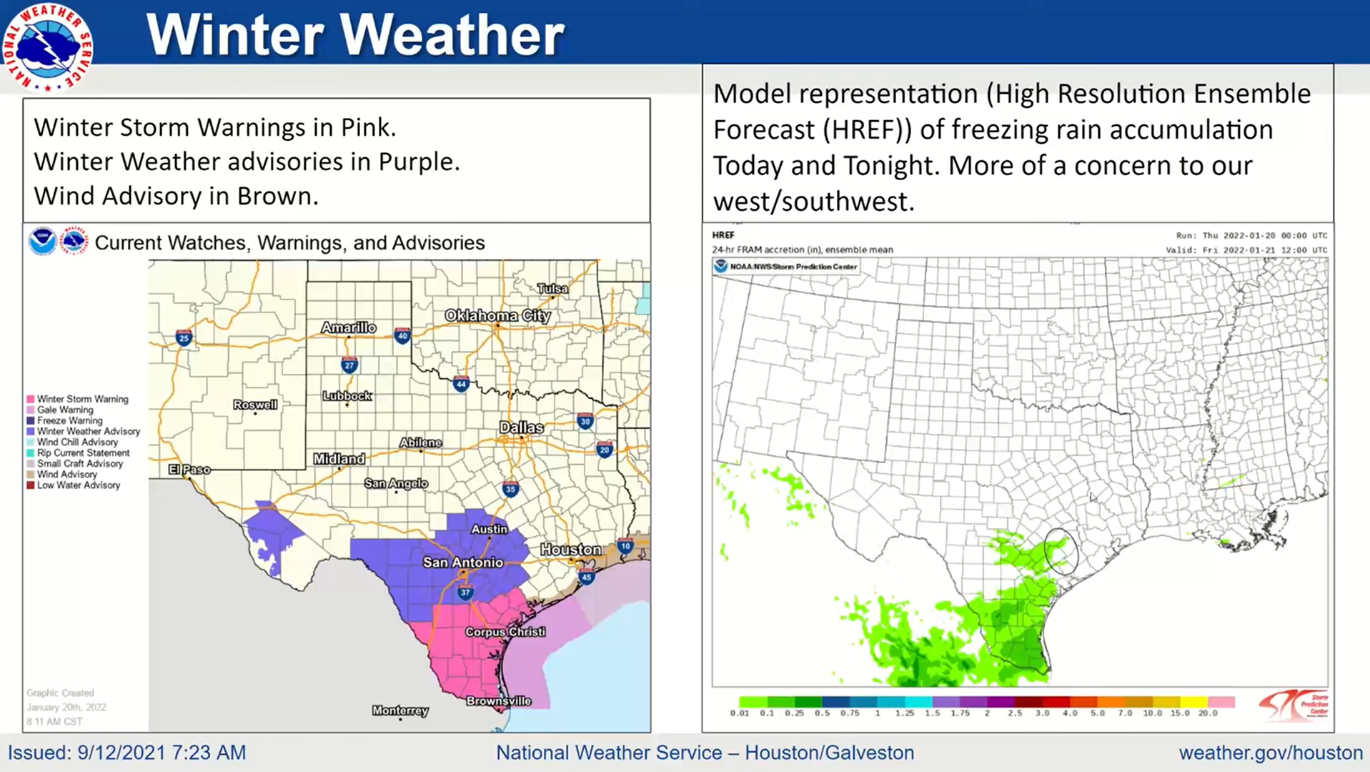
The strong cold front that arrived Wednesday night has brought a risk of wintry precipitation tonight through tomorrow morning, mainly south of Interstate 10, according to a Special Weather Statement issued by the National Weather Service Thursday morning, Jan. 20.
“Steadily falling temperatures can be expected across much of Southeast Texas today,” the Thursday statement said. “Overnight tonight and on into early Friday morning, readings are expected to approach freezing for parts of the area. Any lingering rain areas will have the potential to interact with the near freezing temperatures and transition into a wintry mix of freezing rain and sleet.”
Although it said the main areas of concern are south of I-10, especially closer to the Edna-Bay City-Matagorda Bay area, the statement included Austin County and the Cities of Sealy and Bellville alongside neighboring counties.
In a Thursday morning briefing from NWS, Winter Weather advisories had been issued for many counties west of Austin County but the area was being monitored and could have an advisory issued later tonight. Many forecast models predicted freezing rain accumulation to miss Austin County however it wasn’t expected to be more than 0.1 inches.
NWS said in a Wednesday statement that driving conditions have the potential to worsen in colder temperatures.
“Driving could become treacherous or dangerous if these conditions materialize. If possible, stay off the roads,” a Wednesday morning update said. “Conditions will improve on Friday as the near-freezing, early-morning temperatures warm back up as the day progresses into the mid-to-upper-40s.”
Sealy ISD Superintendent Bryan Hallmark addressed the driving conditions in a Thursday afternoon update where he said it’s business as usual at the moment.
“Right now we are planning to operate on a normal schedule tomorrow,” Hallmark said in a Jan. 20 message to parents. “We will monitor the weather and road conditions overnight and should we need to run a delayed schedule, we will notify you via Remind, SchoolMessenger, and Facebook by 6:00 a.m.”
The Houston-Galveston office of the NWS advised anyone who does drive to slow down, don’t use cruise control and leave plenty of distance between you and other vehicles.
“The winter season brings many weather events that can ‘sneak’ up on you. These are winter hazards that cause big impacts and make travel difficult without making big news,” it says on an infographic. “Ice can form on roads and lead to dangerous travel when the air temperature or road temperature drops below freezing.”
Still, Jeff Lindner, Director of Hydrologic Operations Division/Meteorologist for Harris County Flood Control District, concurred this cold won’t resemble last year’s Winter Storm Uri because the temperatures are expected to rise above freezing during the day.
“Pipes will be fine through the event … just drain and protect outside sprinkler systems. Tropical or sensitive plants should be protected all other will be fine,” Lindner said in a late-morning update Wednesday. “Lows Friday AM: 29-37. Lows Saturday AM: 27-33. … Power supply/infrastructure issues are unlikely.”
Stay tuned to The Sealy News’ social media pages and sealynews.com for the latest updates on the front.
