Three winter storms approaching
Middle system could bring record-setting cold, NWS says
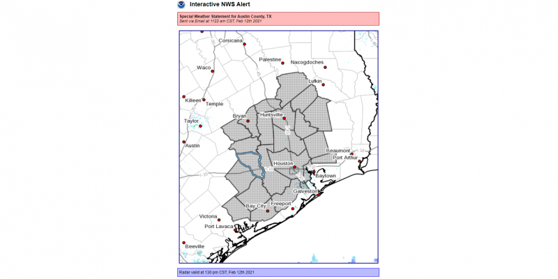
Three winter storm complexes will move through the region, a Friday afternoon Special Weather Statement from the National Weather Service states. Areas affected include Austin and neighboring counties, among others, as well as the cities of Columbus, Sealy, Bellville, Eagle Lake, Brookshire and others.
The first of the 3 systems will be arriving early Saturday evening and overnight. Near-freezing temperatures will be in place with a threat of freezing rain and sleet. Precipitation amounts should be light but even so, icy roads will be an issue, especially along and north of a line from Bellville to Conroe to Livingston.
The second system is likely to bring record-setting cold to the region.
- Bitterly cold air will be moving into the region behind an Arctic cold front Sunday night into Monday morning. Temperatures will abruptly plummet below freezing with strong gusty northerly winds.
- Freezing rain changing over to snow is likely with this system.
- Prolonged periods of freezing temperatures are expected with low temperatures Tuesday morning 5 to 15 degrees.
- The combination of both cold temperatures and winter precipitation has the potential to significantly impact life and property.
- Travel will be severely impacted by hazardous icy and snowy road conditions. Sporadic power outages will be a possibility. Pipes and sprinkler systems may burst if not properly cared for in advance. Do so now!
- You should plan to stay put for at least a day given where you are Sunday night because travel may be extremely hazardous Monday.
- Hypothermia will be a possibility for those not dressed appropriately. Brutally cold wind chill readings of -7 to 10 degrees will be likely Monday through Tuesday morning.
- Remember the 4 P's: pipes, people, pets and plants. In addition, be aware of space heater dangers if not properly placed/used.
The third system arrives sometime Wednesday and could bring another round of freezing rain or snow to the region. It will extend the cold weather, and although it will not be as cold as Monday night and Tuesday morning, it will also continue the winter hazards.
Confidence on timing and impacts is lower on this system given the potential for an extensive snow cover to be present across the Southern United States and the potential feedback into the third system.
Stay tuned to local media outlets for further developments and any road closures.


